How to find coal power plants that are set to retire in PVcase Prospect


Do you wish you could identify coal power plants that are set to retire? Wish no more!
This new Energy Community map layer, courtesy of the Department of Energy and the NETL, identifies coal power plants that have been closed or set to retire, alongside key infrastructure characteristics that are crucial to identify potential development opportunities in line with the Inflation Reduction Act (IRA). You can watch this video for a quick overview, or read the entire writeup below.
Full writeup
Here’s how to make the most of this IRA layer in PVcase Prospect.
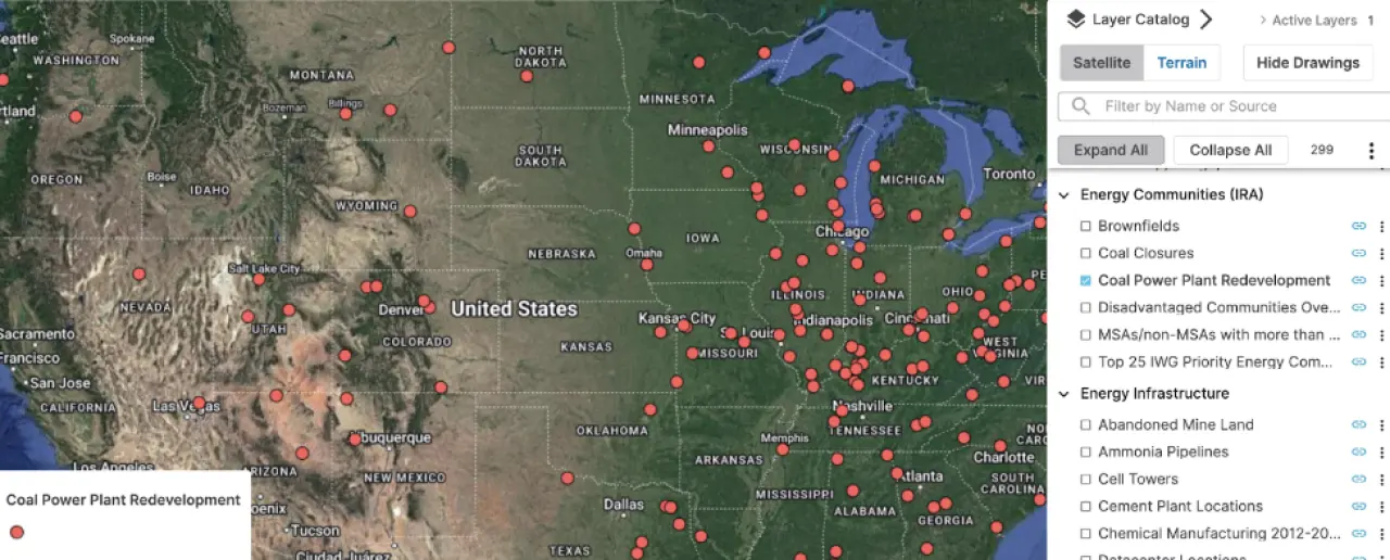
To view/filter coal plant data in bulk in a given area, toggle on the layer.
1. Click on Map Tools > Select by Polygon > Features from a Layer > Coal Power Plant Redevelopment.
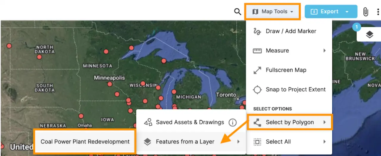
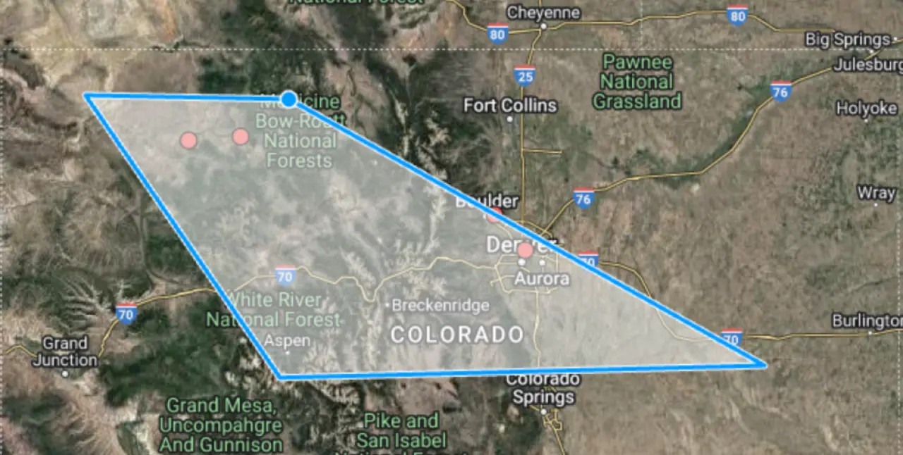
2. The polygon tool will appear. Create your own polygon.
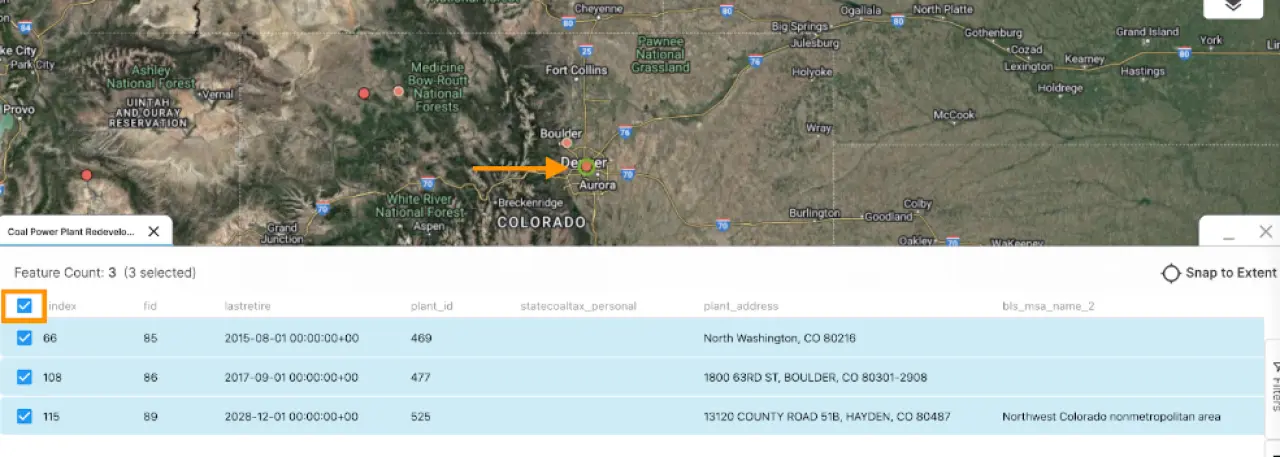
3. The Coal Plants within the polygon will appear in a table view, as shown below. Filter to by the desired attribute(s). (i.e. last retire date, federal quantified opportunity zone, etc.)
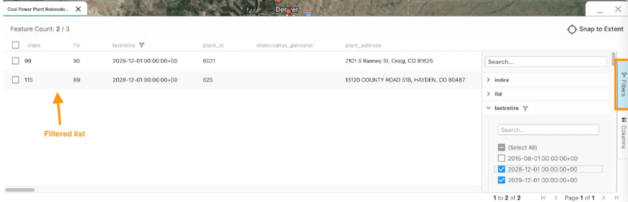
4. Select the desired plants by clicking on the checkbox next to each plant to find where a particular plant is located on the map. To select all, click the checkbox in the header column. Green halos will appear around the selected plants. Zoom in/out of the map to view all filtered plants.
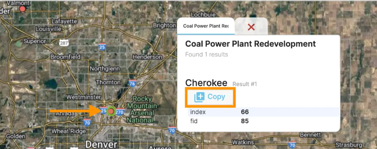
5. To copy the coal plant to your project, click on the plant icon and click on Copy in the pop-up.
Interested to see what PVcase Prospect can do? Book a demo via the link below!