


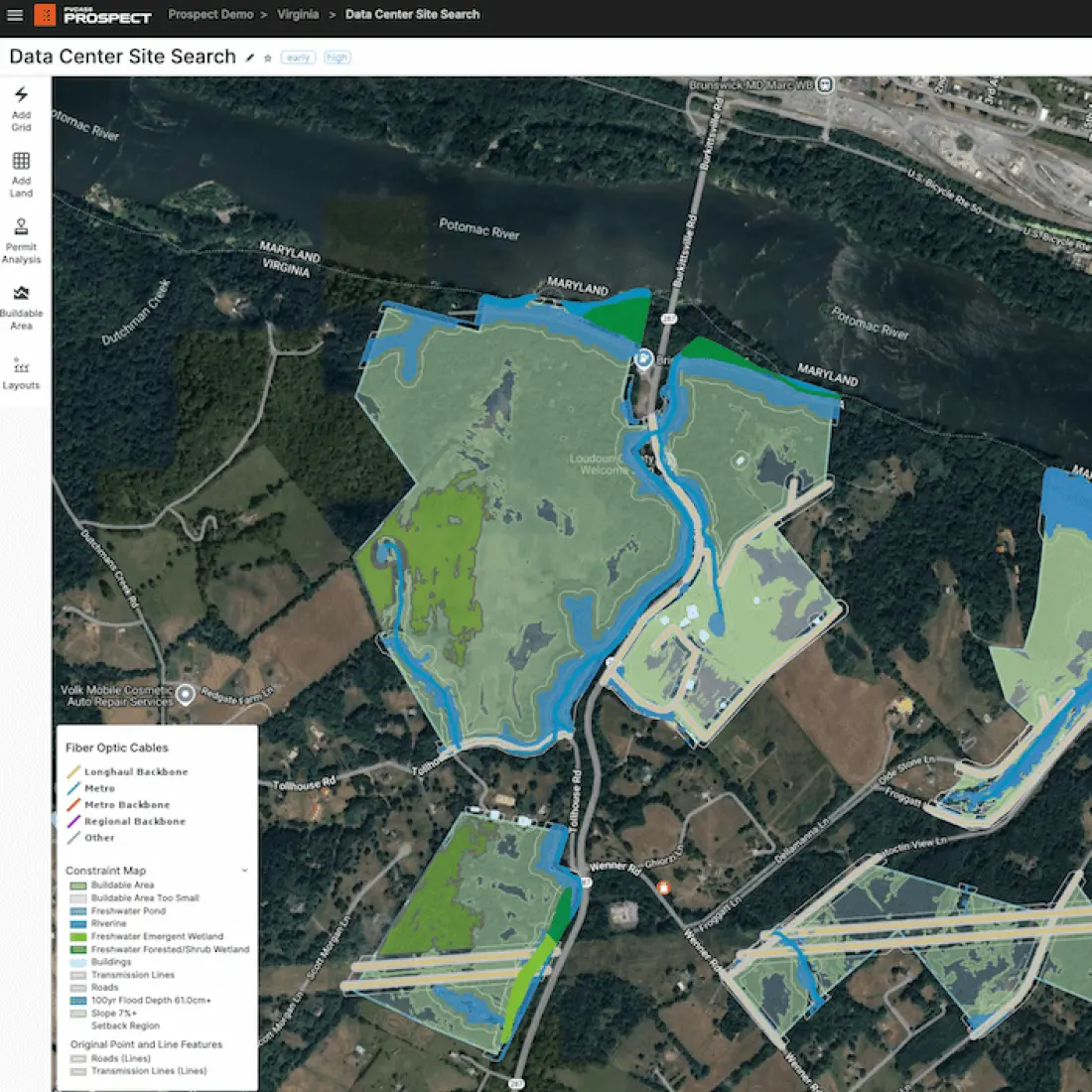
Grid, parcels, environmental, economic, and regulatory data - all integrated and ready to use.
Boost your spatial analysis capabilities using PVcase
Upgrade from conventional GIS to a solution tailored for solar energy.

Industry-leading GIS capabilities right out of the box
Transform weeks-long project cycles into minutes, driving greater productivity and pipeline expansion for your team.
Extensive datasets
Access hundreds of current, ready-to-use layers: grid infrastructure, environmental, economic, and more.
Automated spatial queries
Instantly surface parcels, boundaries, and constraints that match complex project criteria.
Seamless integration
Export GIS data, shapefiles, and reports for use in your wider geospatial workflows.
Streamlined project collaboration
Facilitate seamless data sharing between GIS and other teams, ensuring everyone stays aligned throughout the project lifecycle.
Take your GIS workflow to the next level in 3 steps:
Configure your spatial preferences: Define search parameters, constraints, and data layers relevant to your project.
Perform automated analysis: Instantly visualize buildable, unbuildable, and restricted areas with rich, interactive maps.
Share your findings with a simple export: Generate GIS exports, reports, and maps for seamless integration into your organization’s workflow.
Unlike traditional GIS tools, PVcase enables:
Instant, high-quality outputs: Transform manual workflows into automated processes for rapid, reliable results.
Consistent, up-to-date data:
Never worry about outdated layers - PVcase ensures accuracy and currency every time.Effortless reporting and sharing:
Generate customized exports for stakeholders inside or outside your organization.
Frequently asked questions
Ready to experience the new way of working?
Turn complexity into clarity and confidently move your solar project forward with PVcase solutions.