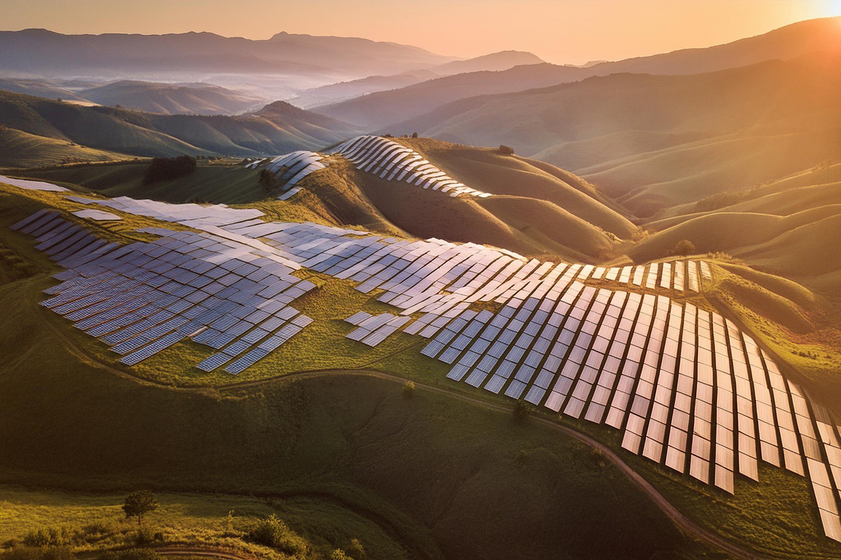
PVcase proudly presents a new functionality allowing you to add terrain-following trackers to your solar projects in the PVcase Ground Mount tool.
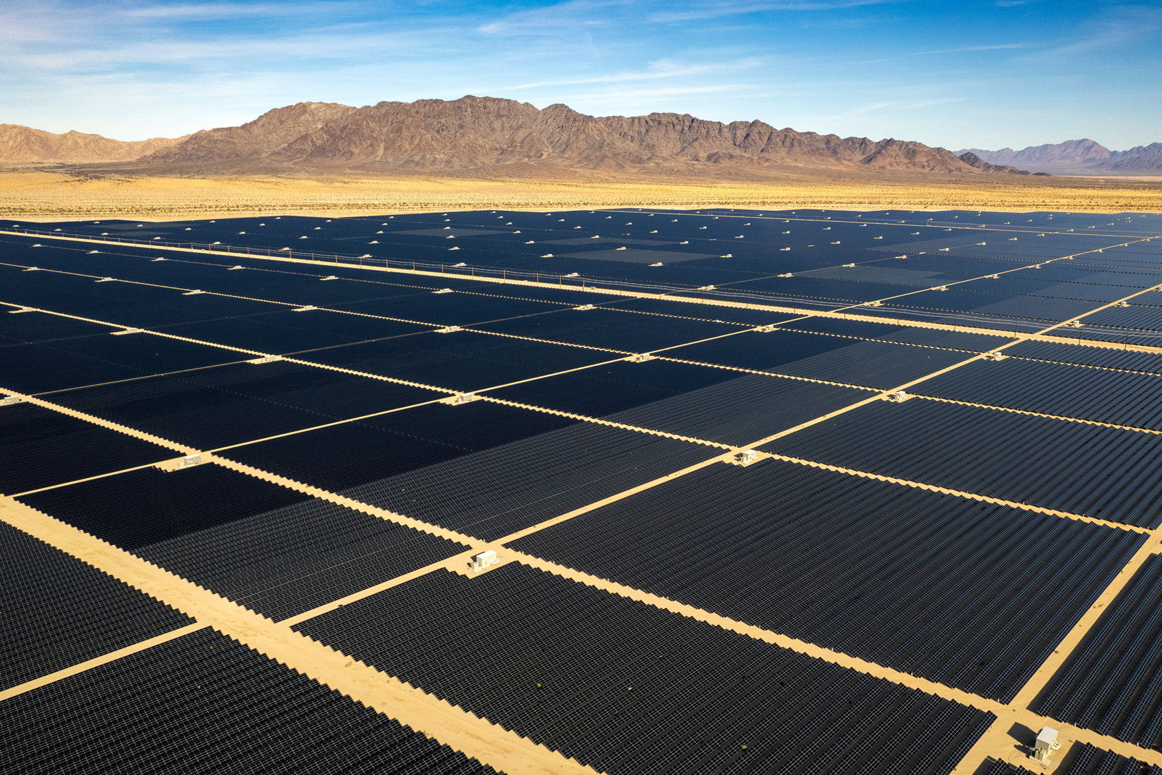
Ideal sites are getting more difficult to find, so terrain-following trackers allow engineers to adapt solar plants for more complex landscapes. Terrain-following trackers mitigate risks associated with undulating terrain and improve project-level economics. Unlike traditional trackers that require extensive grading and steel foundation, this slope-adaptive architecture allows for a constant pier reveal height, which results in a terrain-following tracker installation that reduces grading costs by 30% to 90%.
This design reduces earthwork costs and limits opportunities for soil erosion, resulting in improved soil integrity and reduced operations and maintenance costs over the operational life of an asset. Furthermore, the grading reductions also mitigate risks associated with unpredictable project variables, such as environmental review, grading-related change orders, and schedule delays, that span the project development timeline.
How do they work?
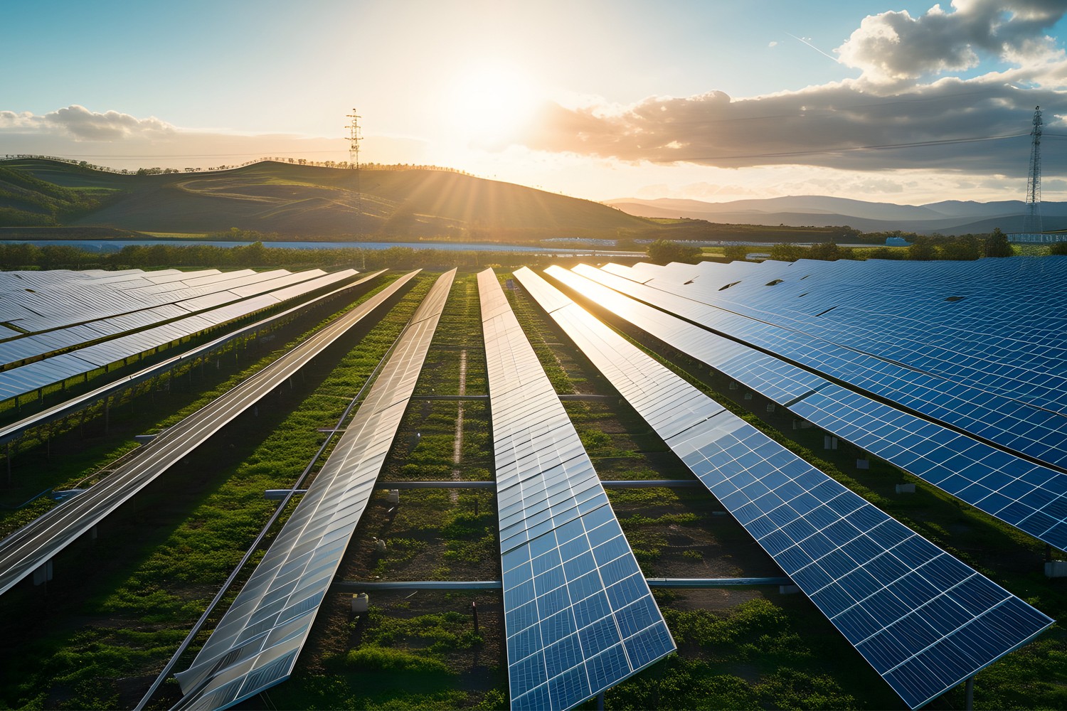
Basically, a terrain-following tracker is a segmented regular tracker with segments that allow the tracker to fit more easily onto uneven terrain. An excellent example would be a rope on the ground. If you lay it on the ground, it follows the undulations as opposed to a plank that stays flat. So the standard tracker is like a plank, while the terrain-following one is like a rope that can bend according to the surface.
Terrain-following trackers use sensors to detect the angle and direction of the sun, as well as the position and slope of the ground. These sensors can include GPS, accelerometers, inclinometers, and other devices.
The data from the sensors is sent to a controller, which calculates the optimal position for the solar panels based on the position of the sun and the contour of the ground. The controller then sends commands to the motors to adjust the position of the panels.
Terrain-following trackers use motors to adjust the position of the solar panels in real time. The motors can tilt, rotate, or pivot the panels to match the ground’s contour and maximize the amount of sunlight they capture.
The solar panels are mounted on a structure that allows them to move in response to the commands from the controller. The mounting system is designed to be strong and durable, to withstand the stresses of movement and changes in weather.
Terrain-following trackers require a power supply to run the sensors, controllers, and motors. The power can be provided by a battery, a grid connection, or a combination of both.

Benefits of terrain-following trackers
Here are some of the benefits of terrain-following trackers:
– Increased energy production. Terrain-following trackers can increase energy production by up to 5-15% compared to fixed-tilt systems. By adjusting the panel angle to match the terrain, the panels can capture more sunlight throughout the day.
– More stable output. The angle of the panels in a terrain-following system changes throughout the day to match the contour of the land. This leads to a more stable output, as the panels are always positioned to capture the maximum amount of sunlight the terrain allows.
– Better adaptability. Terrain-following trackers are ideal for uneven or sloped terrain, as they can adjust to the angle of the land. This makes them a good choice for locations where fixed-tilt or standard single-axis tracker systems would be impractical.
– Lower costs. By increasing energy production and reducing the amount of ground grading required, terrain-following trackers can be more cost-effective than fixed-tilt or standard single-axis tracker systems.
– Reduced environmental impact. Terrain-following trackers can reduce the environmental impact of solar installations by minimizing land use and preserving natural habitats. By reducing the amount of ground movement needed for solar installations, terrain-following trackers can help protect natural resources and ecosystems.
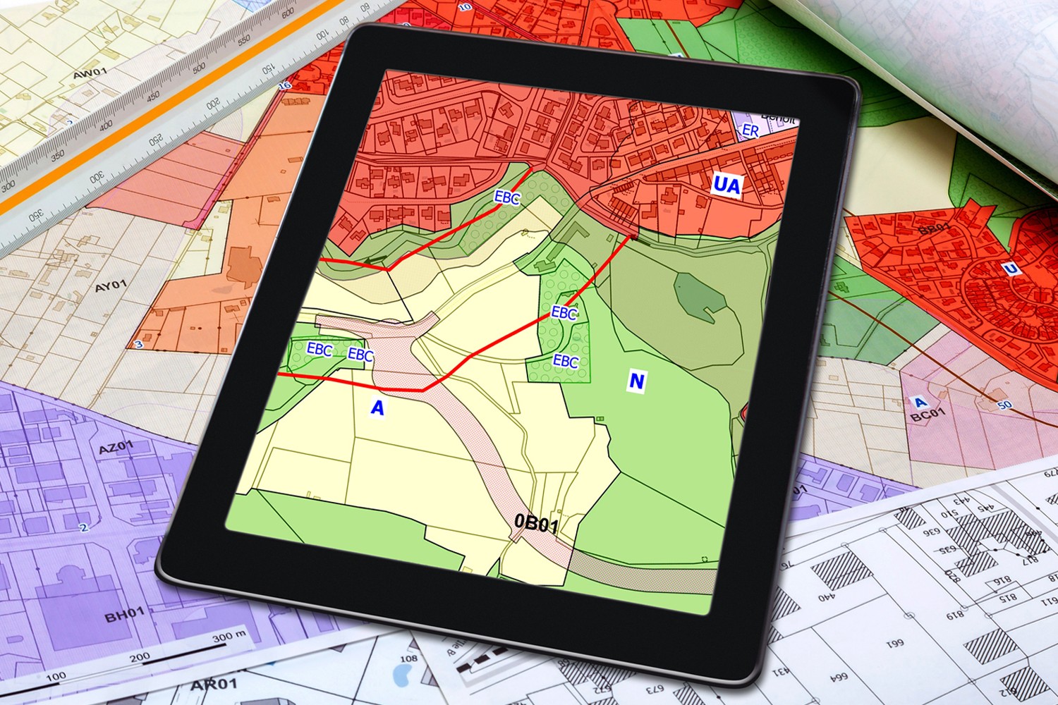
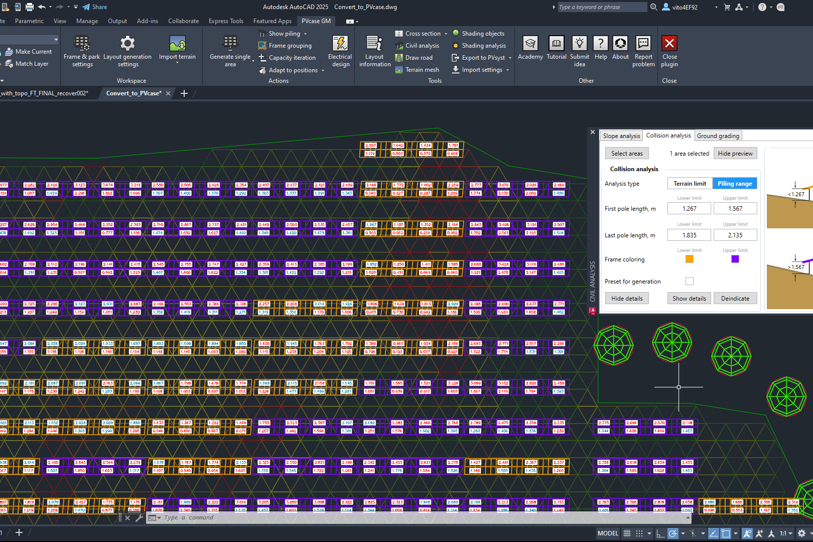
Now you can also grade multiple areas at once
Now you can grade more than one area at once. This will save you a lot of time with your ground-grading tasks.
You can easily locate this feature under the Ground grading tab in the Civil analysis section. By clicking the Grade the selected surfaces button, you can grade your chosen surfaces.
Check out more info on our new functionality and schedule a demo.
You might also be interested in:
Siting of PV power plants. How to adapt solar designs to complex terrains?
Choosing the wrong PV project site lowers energy output, raises costs, and risks legal issues. PVcase offers solutions. Discover them by reading the article.
Overcoming technical challenges in renewable energy projects. How PVcase transformed OHLA’s design process
Explore how OHLA overcame renewable energy design challenges with PVcase, streamlining solar park operations and achieving remarkable business growth.

Bridging the renewable energy skills gap. A success story of PVcase, Enery, and the University of Applied Sciences Upper Austria
Discover how PVcase, Enery, and the University of Applied Sciences Upper Austria have collaborated to prepare future solar engineers through an innovative educational initiative,…
Top 10 questions from Intersolar Europe 2024, answered
Get answers to the top 10 questions asked during Intersolar Europe 2024 that cover PVcase Prospect's availability, integration of PVcase products, and much more. Your question is…
Targeted solar marketing for successful landowner outreach — e-book included!
Discover how innovative strategies and Anderson Optimization's GIS Site Selection can boost solar outreach ROI and conversions. Download the ebook for more insights!
PVcase is part of the 42-month long SUPERNOVA project
PVcase, together with 19 partners from all over the world, is part of the 42-month SUPERNOVA project, focusing on O&M and grid-friendly solutions for reliable, bankable, and…
PVcase tools are now compatible with AutoCAD 2025!
We’re happy to announce that you can now use PVcase Ground Mound and Roof Mount, our flagship CAD-based tools, on AutoCAD 2025, enjoy its multiple functionalities and integrate…
PVcase is the finalist of “The smarter E AWARD” in the Photovoltaics category
We’re the finalists of “The Smarter E AWARD”! Read more about the nomination and dive into the PVcase Integrated Product Suite offering that innovates the industry.
Making great designs on good sites—the importance of topo data for PV design
Topo data is the first step in determining the success of your solar project. While the terrain is crucial in this regard, developers should also consider grid connectivity and…
How policy can shape future solar energy expansion
Policymakers and regulatory organizations must actively support solar power's growth and renewable energy advancement. Read the article to learn how.
Shading Analysis: advanced feature for C&I roof-mount solar projects is live
Shading Analysis is live! Read the article to learn about benefits, capabilities of the tool, and how it can help users and decision-makers.
PVcase wins the BNEF Pioneer Award 2024 for innovative solar design solutions
We won the prestigious 2024 BNEF Pioneers Award! Find out how our software contributes to relieving bottlenecks in the deployment of clean power.
Sustainable cities: what urban living of the future might look like
From clean energy to green bonds and renewable energy stocks, there are many ways you can invest your money in a sustainable future. Find them out by reading the article.
8 ways to invest your money in a sustainable future
From clean energy to green bonds and renewable energy stocks, there are many ways you can invest your money in a sustainable future. Find them out by reading the article.

8 business opportunities in renewable energy
There are many potentially lucrative business opportunities in renewable energy. Learn how you can use these opportunities to make money while contributing to the green…